Does anyone know where I can find a really detailed map of the Phong Nha area that shows hiking trails and cave locations? I’ve been relying on Google Maps but it doesn’t have enough detail for the trekking routes I want to explore. I’m planning some self-guided adventures and want to make sure I don’t get lost in the jungle. Are there printed maps available at the visitor center or should I download something specific before arriving? I’ve heard about topographic maps but not sure where to access them. My phone battery tends to die quickly when I’m taking lots of photos so having a physical backup would give me peace of mind. Also wondering if there are any apps that work offline and have good trail information for the national park area.
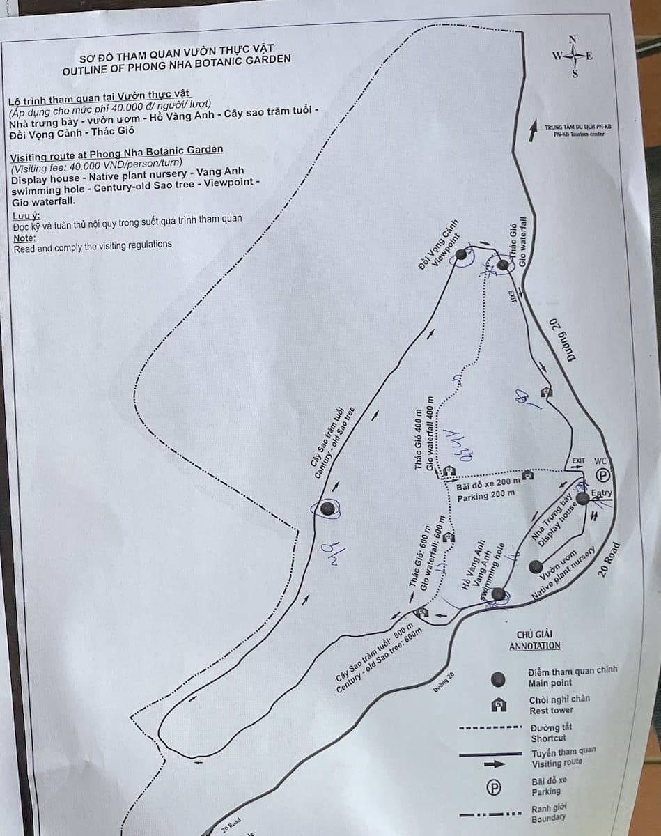
Well I can give you map of Phong Nha botanic garden at the very least
another phong nha tourist map here
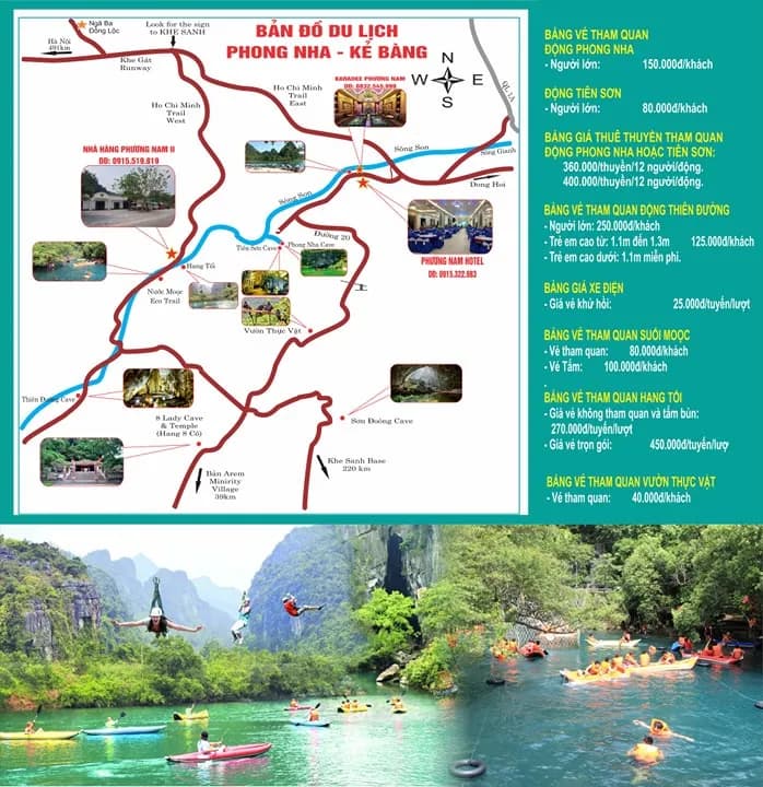
Source: PHONG NHA KE BANG TOURIST MAP - Phong Nha Ke Bang Daily Tours
For the trail map of phong nha caves, you would have to find it at reception of cave tours like Phong nha cave, paradise cave etc
Just take a picture I guess.
also did you check ALLTRAILS website and search for Phong Nha? I would look there